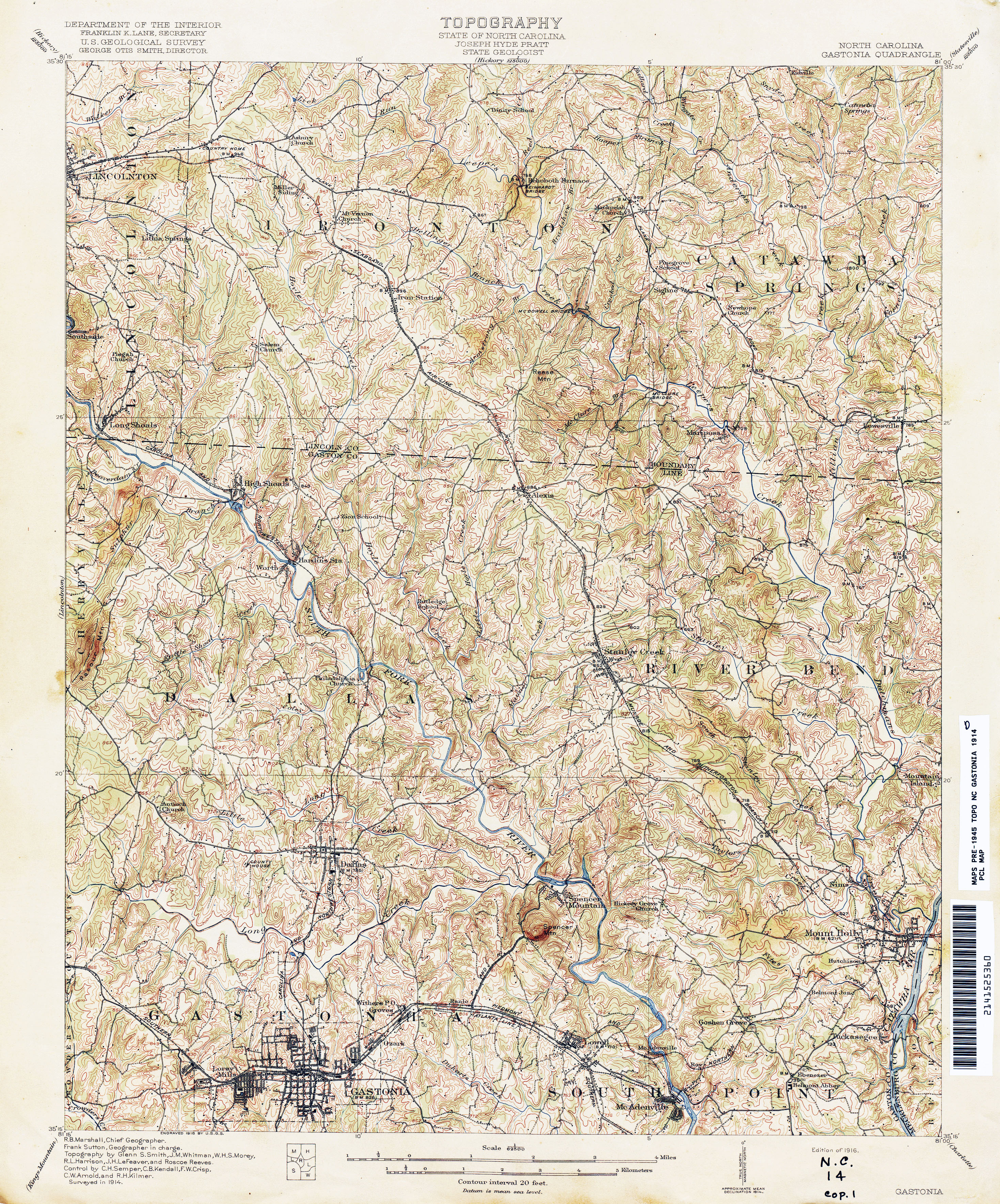
U.S. Geological Survey Topographic Maps are general-use maps at medium scales that present elevation (contour lines), hydrography, geographic place names, and a variety of cultural features. Includes current-generation and historic maps.
Go to: https://ngmdb.usgs.gov/topoview/viewer/#4/39.98/-100.06
Go to: https://store.usgs.gov/filter-products?country=US&sort=old_first&page=1
The North Carolina Geological Survey Topographic Maps website provides information about USGS topographic quadrangle maps for the state of North Carolina that are available through the N.C. Geological Survey.
Go to: https://deq.nc.gov/about/divisions/energy-mineral-land-resources/north-carolina-geological-survey/Topograhic-maps
USGS Historical Topographic Map Explorer Search a collection of more than 170,000 USGS topographic maps that date from 1884 to 2006. Historic maps can overlay on current map and can be downloaded as GeoPDFs.
Go to: http://historicalmaps.arcgis.com/usgs/
Historic Digital NC Topographic Maps provides maps with valuable historical information about landscape features from the past. Map dates range from the late 1800s to the 1960s. In order to view the images, you will need to download a free viewer or software capable of viewing JPEG2000 images. See website for known free applications.
Topographical Maps of South Carolina, 1888-1975. Measuring 14 ½ x 20 inches, these Polyconic Projections were first published in the late 19th Century. Some were produced by the Army, others by the Corps. of Engineers and the remainder were produced by the United States Geological Survey (USGS). The scale is 1:62500. Go to: https://digital.library.sc.edu/collections/topographical-maps-of-south-carolina-1888-1975/
©Copyright 2021, Gaston County Public Library. All Rights Reserved.